University of Northern Iowa
 |
|
| Motto | Lux (Latin) |
|---|---|
|
Motto in English
|
"Light" |
| Type | Public |
| Established | 1876 |
| Endowment | $107.6 million (2016)[1] |
| President | Mark Nook |
|
Academic staff
|
800 |
| Undergraduates | 10,104[2] |
| Postgraduates | 1,801[3] |
| Location | Cedar Falls, Iowa, U.S. |
| Campus | Urban, 900 acres (3.6 km2) |
| Colors | Purple and Gold[4] |
| Athletics | NCAA Division I – MVC |
| Nickname | Panthers |
| Sports | 15 varsity teams |
| Mascot | TC Panther (the male panther) & TK Panther (the female panther) |
| Website | www |

The University of Northern Iowa (UNI) is a university located in Cedar Falls, Iowa, United States. UNI offers more than 90 majors across the colleges of Business Administration, Education, Humanities, Arts, and Sciences, and Social and Behavioral sciences, and graduate college.
UNI has consistently been named one of the "Best in the Midwest" in the Princeton Review Best 351 College Rankings guide, and has ranked second in the category "public regional universities (Midwest)" by U.S. News & World Report for twelve consecutive years.[5] UNI's accounting program has consistently ranked in the top 10 universities in the nation for the pass rate of first-time candidates on the CPA Exam.
More than 90 percent of classes have fewer than 50 students;[6] they are mostly taught by faculty, not teaching assistants. Tenured and tenure-track faculty teach 75 percent of UNI's classes. The Fall 2016 enrollment is 11,905.[3] More than 90 percent of its students are from the State of Iowa.
Contents
History[edit]


The University of Northern Iowa was founded as a result of two influential forces of the nineteenth century. First, Iowa wanted to care for orphans of its Civil War veterans, and secondly, Iowa needed a public teacher training institution. In 1876, when Iowa no longer needed an orphan home, legislators Edward G. Miller and H. C. Hemenway started the Iowa State Normal School.[7]
The school's first building opened in 1869 and was known as Central Hall. The building contained classrooms, common areas, and a living facility for most of the students. It was also a home to the college's first principal, James Cleland Gilchrist. The building was the heart and soul of the school, allowing students to study courses of two-year, three-year, and four-year degrees. In 1965, a fire destroyed Central Hall, and school faculty and Cedar Falls citizens donated over $5,000 to start building Gilchrist Hall.[7]
The school has been known under the following names:
- Iowa State Normal School, 1876–1909
- Iowa State Teachers College, 1909–1961
- State College of Iowa, 1961–1967
- University of Northern Iowa, 1967–present
Student newspapers:
- Students Offering, 1888–1889
- Normal Eye, 1892–1911
- College Eye, 1911–1967
- Northern Iowan, 1967–present

Academics[edit]
University of Northern Iowa Colleges include:
- Business
- Education
- Humanities, Arts and Sciences
- Social and Behavioral Sciences
- Graduate College
Student statistics[edit]
The class entering in Fall 2016 had more than 2,000 students enroll. The mean ACT composite for admitted freshmen was 22.91. 2016 marked the most diverse class in UNI's history with 11.2 percent minority students. Minority students now account for just under 10 percent of UNI's student body.[3]
Educational opportunities[edit]
The University of Northern Iowa has a very active program of allowing students to pursue educational opportunities outside the state of Iowa and also the country. Students have the ability to study aboard or study at another North American institution though National Student Exchange.
Liberal arts[edit]
UNI has implemented a Liberal Arts Core (LAC) in order to provide a common liberal-arts foundation for all undergraduate students.
| LAC | Categories |
|---|---|
| Category 1 | Core Competencies |
| Category 2 | Civilizations and Cultures |
| Category 3 | Fine Arts, Literature, Philosophy and Religion |
| Category 4 | Natural Science and Technology |
| Category 5 | Social Science |
| Category 6 | Capstone Experience |
Study Abroad Center[edit]
UNI provides an opportunity for the students to study in 25+ countries and select from over 40 programs.[8] In addition to semester and academic year programs students may choose to take part in summer, faculty-led, and short-term programs abroad. Many semester and year-long programs are exchanges in which students continue to pay UNI tuition to attend international partner schools. UNI also offers research, internship, and student teaching opportunities abroad. All exchange programs offer courses in English as well as training in the local language, if desired. Students interested in improving foreign language skills have many program choices available to them through UNI Study Abroad programs. UNI Study Abroad Center also offers scholarships to qualified students studying overseas.
Study Abroad participation is rapidly increasing at UNI as more financial support is being offered by individual campus colleges. Internationalization has been integrated into the most recent draft of UNI's Strategic Plan.
Culture and Intensive English Program[edit]
The Culture and Intensive English Program (CIEP) is an intensive program in English for non-native speakers. It is designed to prepare students for academic work at the undergraduate or graduate degree level. University of Northern Iowa students are also encouraged to participate in the Conversation Partner Program to help foreign students with their English ability and foster cross-cultural relationships while gaining mutual understanding.
North American Review[edit]
The university is the publisher of The North American Review (called the NAR), a celebrated literary magazine that began originally in Boston in 1815. Its past editors have included James Russell Lowell, Charles Eliot Norton, and Henry Adams; while among its past contributors are Mark Twain, Henry James, Joseph Conrad, Walt Whitman, Kurt Vonnegut, Joyce Carol Oates, Guy Davenport and Margaret Atwood. In 1968, when the magazine was purchased by UNI, Robley Wilson was appointed editor, a position he continued in until his retirement in 2000. The current editors are Grant Tracey and Vince Gotera.
In S. Duperray and R. Vidaling, Front Page: Covers of the Twentieth Century (London: Weidenfeld and Nicolson, 2003) the NAR is featured with Paris Match, The New Yorker, Vogue and twenty-four other famous magazines, and is described as being "a real institution in the United States, as much for its quality as its longevity." Since its acquisition by UNI, that book continues, the magazine has "distinguished itself" by winning a long list of prizes, both in literature and design. It has twice won the National Magazine Award for Fiction and was a finalist for that award five times; placed stories in the annual O. Henry anthologies four times, in the Pushcart Prize annuals nine times, in Best American Short Stories eight times, in Best American Essays twice, in Best American Sports Writing and Best American Travel Writing. As for its graphics, the NAR has been represented three times in Communication Arts illustration annual, twice in the Society of Publication Designers' annual, and four times in the Print regional design annual, and twice it has won the "Ozzie" gold award for best cover among consumer magazines with a circulation of less than 100,000.
Teaching and Research Greenhouse[edit]
The University of Northern Iowa Teaching and Research Greenhouse is a greenhouse complex incorporating botanical gardens for research and education. It is located on the campus of the University of Northern Iowa in Cedar Falls, Iowa.
The greenhouse contains plants from many ecotypes, including 250 tropical plants, an extensive collection of arid climate plants, and the 1,200-square-foot (110 m2) Aquatic Learning Center
Campus buildings[edit]
- Baker Hall - Faculty offices. Formerly an all male residence hall, demolished in 2014 (replaced by a parking lot)
- Bartlett Hall - Faculty offices. Formerly a residence hall.
- Bender Hall - Coed Residence Hall (Towers Complex)
- Begeman Hall - Newly Renovated Physics Building - opened October 5, 2007
- Biology Research Complex
- Communication Arts Center - Location of radio station KUNI (FM)'s studios.
- Campbell Hall - Coed (formerly female only) residence hall.
- Curris Business Building
- Center for Energy & Environmental Education
- Center for Educational Technology
- Center for Urban Education - Located in Waterloo
- Dancer Hall - Coed Dormitory (Towers Complex)
- Gallagher-Bluedorn Performing Arts Center
- Gilchrist Hall - Administration building. Closed until 2008 due to arson fire during homecoming, Fall 2005, now reopened[9]
- Greenhouse Annex - Part of the McCollum Science Hall
- Hagemann Hall - Coed Dormitory (formerly all female, part of Quads Complex)
- Industrial Technology Center - Academic Building
- Innovative Teaching and Technology Center - Previously known as the East Gymnasium. Former Women's Gym. Remodeling was completed late Spring 2006
- Kamerick Art Building - Academic Building; houses the University of Northern Iowa Gallery of Art
- Latham Hall - Academic Building
- Lawther Hall - Coed Upperclassmen Residence Hall. Reopened for the Fall of 2017 after closing for renovations in May of 2015.
- Lang Hall - Academic Building housing the communication departments.
- Maucker Student Union- home of UNI's student-run radio station, KULT 94.5 FM[10]
- McLeod Center - Home of UNI Men's and Women's Basketball, Volleyball, and Wrestling
- McCollum Science Hall - Academic Building housing the science departments.
- Museum
- Native Roadside Vegetation Center
- Nielsen Fieldhouse, Former gymnasium of Malcom Price Laboratory School (Special Education Offices and to get your Teacher Name Tags)
- Noehren Hall - Coed residence hall (Part of Quads Complex)
- Panther Village - Apparment-Style residence buildings for juniors and seniors. Will be open to sophomores beginning in the Fall of 2018.
- Redeker Center - Center of Quads Complex. Houses UNI Department of Residence and Piazza Dining Center
- Residence on the Hill (ROTH) - Coed Suite Style Residence Hall for Upperclassmen
- Rider Hall - Coed (formerly male only) residence hall (Part of the Quads Complex)
- Rod Library (Library and also for Teacher Education advising/offices 3/4 floors)
- Russell Hall - Academic building and auditorium housing the Music departments
- Sabin Hall - Academic Building
- Schindler Education Center - Academic Building housing the education departments (Closed for renovations[when?])
- Seerley Hall - Home of the Office of the President. Also an Academic Building, home to the History department
- Shull Hall - Coed (formerly male only) Dormitory, recently remodeled for upperclassmen only (Part of Quads Complex)
- Student Health Center-Student Health Clinic, Counseling Center, Student Disability Services, Violence Intervention Services.
- Student Services Center - Attached to Bartlett Hall, formerly known as East Bartlett
- Strayer-Wood Theatre - Theatre that also houses the theatre department of UNI. Home of Theatre UNI
- Towers Center - Home of the Rialto Dining Center
- UNI-Dome - Stadium with seating for 16,000+. Home of UNI Football.
- Wellness Recreation Center
- Wright Hall - Academic Building housing the Mathematics and Computer Sciences Departments
- West Gymnasium - Home of the UNI Military Science program (ROTC) and men's wrestling practice facility. Former home of UNI Women's Basketball, Women's Volleyball, and Men's Wrestling. On January 12, 2016, the Gym hosted Donald Trump when he was running for President.
Gallery[edit]
-

Latham Hall at the University of Northern Iowa
-

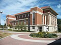
Rod Library at the University of Northern Iowa
-

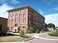
Sabin Hall at the University of Northern Iowa
-

Wellness and Recreation Center at the University of Northern Iowa
-
Russell Hall at the University of Northern Iowa
-
Seerley Hall at the University of Northern Iowa
-
Wright Hall at the University of Northern Iowa
-

Maucker Student Union at the University of Northern Iowa
-

McCollum Science Hall at the University of Northern Iowa
-
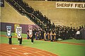
Professors marching in commencement ceremony, December 2005
-

Schindler Education Center
-

The oldest academic building at UNI, Lang Hall
-

West Gym at the University of Northern Iowa
-

Marshall Center one-room school at the University of Northern Iowa


Student life[edit]
Athletics[edit]
The school's mascot is the Panther. They participate in the NCAA's Division I (I-FCS for football) in the Missouri Valley Football Conference, the Missouri Valley Conference for most other sports, and the Big 12 Conference for wrestling.[11] The major arena on campus is the UNI-Dome, currently the home of the football team. The Dome also serves as a venue for many local concerts, high school football playoffs, trade shows, and other events. In 2006, the University opened a new arena, the McLeod Center, to serve as the home for several athletic programs, including volleyball and men's and women's basketball.
UNI Athletics has enjoyed great success lately with the men's basketball team competing in the NCAA tournament three consecutive times in 2004, 2005, 2006, again in 2009 and 2010 and in 2015 and 2016. On March 20, 2010, the men's basketball team defeated the heavily favored, top-seeded Kansas Jayhawks to advance to the NCAA Sweet Sixteen. It was the school's first appearance in the Sweet Sixteen. The Jayhawks were favored to win the NCAA championship. Their Cinderella potential ended with a loss to Michigan State in the Sweet Sixteen, 59-52. The win over Kansas earned them the 2010 ESPY Award for Best Upset.
The football team has been ranked in the I-AA (FCS) top 25 almost every year for the last two decades. The team appeared in the I-AA championship game in 2005, only to lose a close game to the Appalachian State Mountaineers. During 2007, the team was ranked #1 in the country by the TSN FCS poll for several weeks. The football team went undefeated in 2007 with an 11-0 record, a first for any school in the 23-year history of the Gateway conference. In 2001 and 2002 the volleyball team reached the NCAA Sweet 16 round, and in 2006 made it to the second round, and has competed in the tournament numerous times. The track team is also very successful (usually ranked in the top 25), as are the wrestling and volleyball teams.
The University of Northern Iowa wrestling team won the NCAA Division I national championship as ISTC in 1949 and NCAA Division II national championships in 1975 and 1978. They competed in the Western Wrestling Conference until 2012, when UNI became an associate member of the Mid-American Conference since the MVC is a non-wrestling conference. In 2017, UNI wrestling joined the Big 12 Conference. In 1977 the women's softball team won the AIAW national championship.[12]
Bryce Paup won the Defensive Player of Year Award by the Associated Press in 1995. In 1999 and 2001, UNI alumnus Kurt Warner was named NFL MVP by the AP.[13]
During the 2014-2015 season, the men's basketball team ended the regular season ranked #11 by the AP Poll, the highest ranking in school history, and #9 by USA Today.[14]

Traditions[edit]
There are many traditions at UNI.[15] Perhaps the most popular tradition is campaniling. The UNI campanile comes alive Friday night of Homecoming week each year. At the stroke of midnight, students flock around the tower to steal a kiss from a long-time lover or new acquaintance. Oftentimes pins and chap-stick are passed out at the campanile during this time. This tradition began shortly after the tower was constructed in the 1920s. At that time, there were many more women on campus than men. It is said that a male student would call a random female student to meet him at the campanile. The male student would hide in the bushes and if he did not like what he saw, he would leave the girl waiting and go back and call another one instead. It was also "common knowledge" at one time that if a female student was never kissed during campaniling, she was not a true female. The campaniling tradition faded out over the decades but has since been revived with the efforts of the Alumni Association.
There is also a tradition of wearing purple on the Friday of Homecoming. The entire city of Cedar Falls is encouraged to show support for UNI, along with wearing "UNI: Purple For Life" buttons, or any others they have. It promotes a sense of unity and school pride in the community.
A more recent trend, The Interlude, is a dance that is performed to the band "Attack Attack!"'s song of the same name. The Interlude is an all inclusive dance that was started by a small group of students at dance parties during 2010. During the 2010-2011 Basketball season the student section erupted into the dance which helped bring additional publicity. Many attempts at recreating The Interlude have popped up all over YouTube, and the dance has been featured on ESPN as well as regional media outlets, and was mentioned by First Lady Michelle Obama in her May, 2011 commencement speech at UNI.
Fraternity and sorority life[edit]
UNI is home to three NIC fraternities, one unaffiliated fraternity, and four NPC sororities. The university has had a variety of different fraternities and sororities on campus, with many current ones being on campus for an extended period of time since their founding. The university has recently seen a huge increase in membership. Greek Life has always been a mainstay at the university with many members serving on student government and other student organizations on campus.
A main tradition of the fraternities and sororities is the annual Greek Week. Chapters participate in campus wide events such as olympics, lip sync competitions, charity drives, Greek God and Goddess, and Walk a Mile in which men wear red heels and walk an entire mile around campus for sexual assault awareness. Another tradition would be Letter Days, in which members of chapters wear their respective letters as a large community around campus. Yet another tradition would be Greek study tables, where check in tables are provided and members study together in Maucker Union amassing study hours for their chapter's respective scholarship program.
The perhaps biggest tradition of the chapters would be philanthropy. Each individual chapter runs a philanthropy program as well as having community wide ones. Fraternities and sororities are a very big part of UNI Dance Marathon.
UNI is looking to expand its Greek Life in the near future.
Fraternities[edit]
NPC sororities[edit]
Notable alumni, faculty, and staff[edit]
-

John R. Dinger, Ambassador and Diplomat
-

Paul Emerick, USA international rugby player and London Wasps player
-

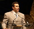
L.J. Fort, Linebacker for the Pittsburgh Steelers
-
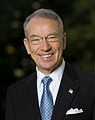
Charles "Chuck" Grassley, United States Senator
-
Jason Lewis, politician, radio talk show host, and political commentator
-

Greg McDermott, head coach of the Creighton Bluejays men's basketball program
-

Abinadi Meza, contemporary visual artist, sound artist, conceptual artist, and filmmaker
-

Tom Pettit, Award-Winning executive and journalist
-

Phyllis Somerville, Broadway, Film and Television Actress
-

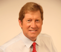
Mark Steines, host of Entertainment Tonight
-
Kurt Warner, NFL MVP and Super Bowl Champion


Alumni[edit]
- Bess Streeter Aldrich, novelist
- Terry Allen, former Missouri State head football coach
- Eddie Berlin, former NFL player
- Bruce Charlesworth, filmmaker and photographer
- John R. Dinger, former U.S. Ambassador to Mongolia (2000–2003)
- Paul Emerick, professional rugby player and three-time Rugby World Cup veteran
- Ali Farokhmanesh, former professional basketball player, made famous shot to beat Kansas
- LJ Fort, Pittsburgh Steelers linebacker
- Joe Fuller, former NFL player
- Mike Furrey, former NFL player
- Jan Spivey Gilchrist, author and illustrator
- Charles Grassley, current U.S. Senator
- Gil Gutknecht, former U.S. Congressman
- Mike Hawker, Alaska State Representative, 2002–present
- Robert John Hibbs, Medal of Honor recipient, 1966, Vietnam war
- Ryan Hannam, former NFL player
- Roger Jepsen, former U.S. Senator
- David Johnson, NFL Running Back for the Arizona Cardinals
- Chris Klieman, head coach of North Dakota State University football
- Bonnie Koloc, vocalist, recording artist
- Joan Larsen, Justice of the Michigan Supreme Court and Donald Trump's nominee for the United States Court of Appeals for the Sixth Circuit
- Pamela Levy, American-Israeli artist
- Jason Lewis, nationally syndicated talk host
- J. Harvey Littrell, pedagogist
- Greg McDermott, current Creighton University head men's basketball coach
- C. Edward McVaney, co-founder and former CEO of the JD Edwards Corporation, an enterprise resource planning company purchased by PeopleSoft in 2002
- Brad Meester, former NFL player
- Brian Meyer, member of the Iowa House of Representatives[24]
- Abinadi Meza, performance artist
- Brian Mitchell, arena football drop kick record holder
- Nick Nurse, basketball coach
- Bryce Paup, 1995 NFL Defensive Player of the Year, 4-time Pro Bowler
- Tom Pettit, television news correspondent for NBC
- Chris Pirillo, former host of TechTV's "Call for Help" show, founder of Lockergnome
- Nancy Jo Powell, current United States Ambassador to India. Former U.S. Ambassador to Nepal, Pakistan, Ghana and Uganda
- Steve Proffitt, senior producer, National Public Radio
- Dorothy Jean Ray, anthropologist
- William P. Robinson, president of Whitworth University
- Dean Schwarz, ceramic artist
- Warren Allen Smith, writer
- Mary Ellen Solt, poet
- Jane Elliott, social activist
- Phyllis Somerville film, theatre and television actress
- Mark Steines, co-host of Entertainment Tonight
- Bill Stewart, jazz musician
- Tyree Talton, former NFL player
- Ed Thomas, high school football coach[25]
- Krista Voda, NASCAR on Fox announcer
- Kurt Warner, two-time NFL MVP, MVP of Super Bowl XXXIV NFL Hall of Fame: Class of 2017
- Will Wilkinson, political writer and policy analyst
- Joey Woody, national champion U.S. hurdler
Notable faculty[edit]
- Donna Alvermann, former professor of education, now distinguished professor and researcher in education at the University of Georgia
- Jeremy Beck, composer, Associate Professor of Composition & Theory (1992–98)
- Herb Hake, television personality
- James Hearst, poet and former professor
- Miguel Franz Pinto, vocal coach, conductor, and pianist
- Nancy Price, novelist, poet, and emeritus professor
- Loree Rackstraw, literary critic and memoirist
- Leland Sage, former professor
- Norm Stewart, former men's basketball coach who went on to become a coach at the University of Missouri
- Robert James Waller, alumnus, former professor and Dean of College of Businesses Administration, author of The Bridges of Madison County
University presidents[edit]
| No. | President | Start of term | End of term |
|---|---|---|---|
| 1 | James Cleland Gilchrist | 1876 | 1886 |
| 2 | Homer Horatio Seerley | 1886 | 1928 |
| 3 | Orval Ray Latham | 1928 | 1940 |
| 4 | Malcolm Poyer Price | 1940 | 1950 |
| 5 | James William Maucker | 1951 | 1970 |
| 6 | John Joseph Kamerick | 1970 | 1983 |
| 7 | Constantine William Curris | 1983 | 1995 |
| 8 | Robert D. Koob | 1995 | 2006 |
| 9 | Benjamin Allen | 2006 | 2013 |
| 10 | William Ruud | 2013 | 2016 |
| 11 | Mark Nook | 2017 | Present |
References[edit]
- ^ "U.S. and Canadian Institutions Listed by Fiscal Year 2016 Market Value of Endow" (PDF). NACUBO.org. Retrieved 24 March 2017.
- ^ https://ir.uni.edu/sites/default/files/2016_uni_factbook.pdf
- ^ a b c "UNI announces fall 2016 enrollment numbers - Newsroom". newsroom.uni.edu. Retrieved 29 August 2017.
- ^ "University of Northern Iowa Web Colors". Retrieved 2017-02-13.
- ^ "University of Northern Iowa | Best College | US News". Colleges.usnews.rankingsandreviews.com. 2010-12-13. Retrieved 2012-09-13.
- ^ "University of Northern Iowa - CollegeData College Profile". COLLEGEdata. Retrieved 29 August 2017.
- ^ a b University of Northern Iowa, Gerald L. Peterson, Aracadia Publishing, 2000.
- ^ "Programs > List All > Study Abroad Center". studyabroad.uni.edu. Retrieved 29 August 2017.
- ^ "Gilchrist Hall". Rod Library.
- ^ "KULT". KULT.
- ^ Nelson, Jim. "College wrestling: UNI welcomes move to Big 12 Conference". Retrieved 29 August 2017.
- ^ "Baseball - Media Guide - Official Site of University of Northern Iowa Athletics". unipanthers.com.
- ^ National Football League Most Valuable Player Award
- ^ "NCAA College Basketball Polls, College Basketball Rankings, NCAA Basketball Polls - ESPN". ESPN.com.
- ^ "Traditions Challenge - University of Northern Iowa". uni.edu.
- ^ "KAPPA SIGMA FRATERNITY AT NORTHERN IOWA - Home". KAPPA SIGMA FRATERNITY
AT NORTHERN IOWA. - ^ "Theta Zeta – University of Northern Iowa". omegafi.com.
- ^ "Sigma Alpha Epsilon". iowachisae.org.
- ^ "Sigma Phi Epsilon Fraternity - University of Northern Iowa -". unisigep.com.
- ^ "Alpha Delta Pi Epsilon Mu". Alpha Delta Pi Epsilon Mu.
- ^ Scotch. "Alpha Xi Delta". alphaxidelta.org.
- ^ "Alpha Phi University of Northern Iowa - Welcome". alphaphiet.com.
- ^ "Gamma Phi Beta". Gamma Phi Beta.
- ^ "The Des Moines Register".
- ^ "Edward Arthur Thomas, 58, Parkersburg". The Daily Freeman Journal. 25 June 2006. Retrieved 14 January 2014.
External links[edit]
Coordinates: 42°30′48″N 92°27′45″W / 42.513361°N 92.462482°W
|
|||||||||||||