Sylvania Waters, New South Wales
|
|
This article has multiple issues. Please help improve it or discuss these issues on the talk page. (Learn how and when to remove these template messages)
(Learn how and when to remove this template message)
|
| Sylvania Waters Sydney, New South Wales |
|||||||||||||
|---|---|---|---|---|---|---|---|---|---|---|---|---|---|

Sylvania Waters
|
|||||||||||||
| Coordinates | 34°01′23″S 151°06′42″E / 34.02318°S 151.11156°ECoordinates: 34°01′23″S 151°06′42″E / 34.02318°S 151.11156°E | ||||||||||||
| Population | 3,125 (2011 census)[1] | ||||||||||||
| Postcode(s) | 2224 | ||||||||||||
| LGA(s) | Sutherland Shire | ||||||||||||
| State electorate(s) | Miranda | ||||||||||||
| Federal Division(s) | Cook | ||||||||||||
|
|||||||||||||
Sylvania Waters is a suburb in southern Sydney, in the state of New South Wales, Australia 21 kilometres south of the Sydney central business district in the local government area of Sutherland Shire.
Sylvania Waters surrounds Gwawley Bay on the southern side of the Georges River. Sylvania is a separate suburb to the west, and Sylvania Heights is a locality within Sylvania. Many of the waterfront areas of Sylvania Waters were reclaimed from Gwawley Bay. Many streets and houses are built on artificial islands. The main road in Sylvania Waters, Belgrave Esplanade, essentially stretches from Tom Uglys Bridge to Captain Cook Bridge - two of the three main northern entry points for the Sutherland Shire across the Georges River.
History[edit]
The naming of Sylvania is unclear, but ‘sylvan’ which means inhabiting the woods, relates to the setting of this suburb. Politician Thomas Holt (1811–88) owned the land that stretched from Sutherland to Cronulla[when?]. Holt had built Sutherland House on the foreshore of Gwawley Bay in 1818, on the eastern side of Sylvania. He established the Sutherland Estate Company in 1881 and a village grew there, with a post office opening in 1883. The school opened in 1884 but closed in 1891 and was not reopened until 1925. Sylvania Heights Public School opened in 1955.
Sylvania Waters Estate was developed by L.J. Hooker in the 1960s, as the land offered had water frontages with boating facilities. James Goyen won the tender to design the estate, construct the houses, and promote the new suburb. Streets were named after Australian rivers to emphasise the association with water, such as Shoalhaven, Tweed, Murrumbidgee, Hawkesbury and Barwon.[2]
Commercial area[edit]
Sylvania Waters is mostly residential, with three small shopping strips located on Belgrave Esplanade. Sylvania Shopping Village is located near Box Road, Sylvania Shopping Centre is near Murrumbidgee Avenue, and the Richmond Centre is near Richmond Avenue. Doltone House is a function centre close to Sylvania Shopping Village.[3] Sylvania Waters has the highest median sale price for houses in the Sutherland Shire Area - $1.618 million (2016).[4]

Sport[edit]
Sylvania Waters is home to the Sylvania Waters Athletics Track, a state-of-the-art facility, where many local and state events are held. Next to this is the Sylvania Waters Tennis Court Complex and the home ground of the Southern Districts Rugby Club.
Culture[edit]
Sylvania Waters was a 1992 reality television program which followed the lives of the Donaher family living at Macintyre Crescent. The suburb became infamous when the series screened across Australia and internationally.
One of the artificial islands in Sylvania Waters (James Cook Island) was used in the filming of the movie Superman Returns (2006) as the location of Lois Lane's house.
-

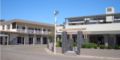
Sylvania Waters shopping village
-
Sylvania Waters shopping centre
-

Doltone House, Sylvania Waters


Population[edit]
In the 2011 census, Sylvania Waters had a population of 3,125 people. The median age of people in Sylvania Waters is 41 years, slightly older than the national median of 37 years[citation needed]. Children aged under 15 years make up 18.3% of the population, and people aged 65 years and over make up 16.9% of the population. Almost one-third (32.3%) were born overseas, similar to the national average of 30.2%, with the top countries of overseas birth being China 4.5%, England 2.2%, Hong Kong 2.0%, New Zealand 1.9%, and Egypt 1.8%. 62.7% of people speak only English at home; the next most common languages spoken at home being Greek 7.9%, Cantonese 5.4%, Mandarin 3.8%, Arabic 3.8%, and Italian 2.7%. The most common responses for religious affiliation are Catholic 29.7%, Anglican 16.7%, Eastern Orthodox 16.3%, No Religion 13.8%, and Buddhism 3.3%. The great majority (78.9%) of households in Sylvania Waters are separate houses, 8.8% were semi-detached, row or terrace houses, townhouses etc., and 12.3% were flats, units, or apartments. The average household size was 2.9 people.[1][5]
References[edit]
- ^ a b Australian Bureau of Statistics (31 October 2012). "Sylvania Waters". 2011 Census QuickStats. Retrieved 2012-11-13.
- ^ The Book of Sydney Suburbs, Compiled by Frances Pollon, Angus & Robertson Publishers, 1990, Published in Australia ISBN 0-207-14495-8, page 251
- ^ "South Sydney Function Venue | SYLVANIA WATERS - DOLTONE HOUSE". Doltone House. Retrieved 2016-12-20.
- ^ "Sylvania Waters Property Market, House Prices & Suburb Profile". www.realestate.com.au. Retrieved 2016-12-20.
- ^ "Sylvania Waters Demographics (NSW) Local Stats". sylvania-waters.localstats.com.au. Retrieved 2016-12-20.
External links[edit]
| Wikimedia Commons has media related to Sylvania Waters, New South Wales. |